Ripon, North Yorkshire, is particularly susceptible to sinkholes, as it is built on gypsum deposits that are prone to being eroded away by groundwater. Sinkholes represent an especially dangerous type of ground movement type, as they are fast moving, occur over relatively short time scales, and are limited in spatial scale. This makes them especially damaging for buildings and infrastructure.
In August 2018, a large supermarket in Ripon was evacuated, after a sinkhole created a hole in an alley behind it
bbc.co.uk/news/uk-england-york-north-yorkshire-45258457.
The SatSense ground movement product captured this event well. The top left panel in the image below gives an overview of the area, with the supermarket outlined in yellow. The top right panel shows the data points available in the SatSense ground movement product, showing an area of subsidence (red points) behind the supermarket. The area is also highlighted by our property damage risk product, as shown by the bottom left panel.
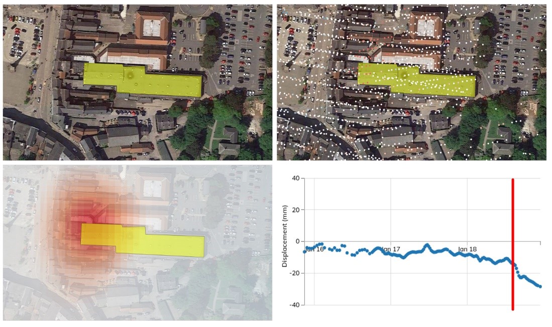
An interesting question is always whether any preliminary movements were visible. The bottom right panel shows the time history for one of the sinkhole measurement points. It clearly shows an increase in movement rate in August 2018, but also shows preliminary movement in the months leading up to the event. This event demonstrates the ability of InSAR data in tracking local events with small preliminary movements, and due to InSAR’s inherent scalability, SatSense can do this countrywide. This also allows ground movement warning systems over widespread assets and infrastructure, one of our main current development areas.