Geotechnical engineers are often posed with challenges when planning construction over
disused mines and quarries. A lack of information as to what materials have been used for backfilling is common, and the historic ground movement of the backfill is likely to be unknown unless extensive in-situ instrumentation has been installed.
At present, geotechnical instrumentation used for building works only provides datasets from the date of installation onwards. As a result, there are years' worth of potential ground movement, resultant of backfilling, that largely remains undetected. Up until now.
Digging for data
At SatSense, we use our novel algorithms to convert satellite data from Sentinel-1 and other higher resolution satellites into highly accurate
ground movement datasets. Our highly-refined InSAR technology has most recently been put to the test by well-respected Civil and Structural Engineering Consultancy firm,
Ramage Young.
At a confidential location on the site of an ex-quarry being considered for a prestigious development, the types of material used for backfilling and the extent of overall ground movement were unknowns. Across the site, engineers were struggling with how to determine movement levels, especially thanks to the quarry’s particularly challenging characteristics.
Being at a rural location previously surrounded by water, and with south-facing slopes, the site was not optimal for InSAR coverage. However, even in these sub-optimal conditions
InSAR was able to yield almost 40% more data points across the site than was possible with traditional monitoring counterparts, such as settlement gauges. These traditional methods required ten site visits between November 2018 and April 2019 to obtain ten sets of measurements, compared to InSAR’s sixty-one sets of measurements across the same six-month period – with no site visits.
Uncovering ground movement trends
Our experts chose to deploy specially developed rural processing chain for this particular quarry. As a result, we were able to identify a good number of movement trends across the site.
Most significantly, the entirety of the site presented downwards movement that has been occurring since 2015 (Figure 1). The highest rates of displacement are recorded between 2015 to mid-2018 (Figure 2), followed by slowing of the displacements to the present day (though still ongoing).
Figure 1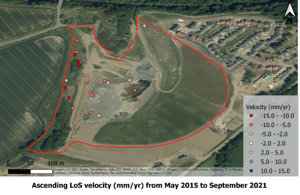 Figure 2
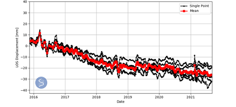
Interestingly, decomposed vertical and horizontal velocities highlight possible slope instabilities around the western extent of the site (Figure 3), information of high importance to the consultant engineers.
Figure 3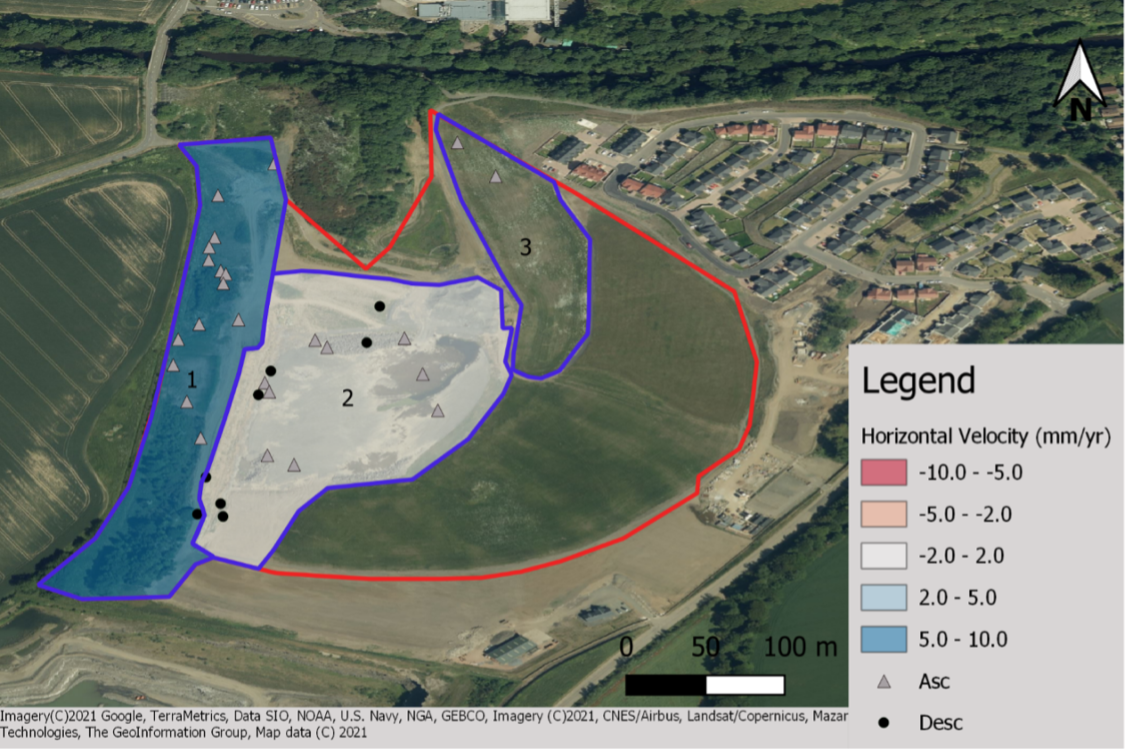
Differential settlements were highlighted by the engineers as being a significant risk for this site. Fortunately, after conducting a differential settlement analysis over the entire site, a low-risk was determined.
Discussing the significance of this information to the project, Ramage Young detail, “The data from SatSense has aided us in ascertaining overall levels and rate of settlement across quarry fill within this particular site. Such historic data would have not otherwise been available to us.”
Increased possibilities for other geotechnical projects
We're now working towards broadening the application of our data across a variety of geotechnical projects. And we've begun to use our INSAR technology to help quantify risks that can be integrated into geotechnical risk registers. This will help identify specific areas across construction sites that require further ground investigations and where ground improvement techniques need to be employed.
Access to accurate, historical ground movement data is helping geotechnical engineers to increase their understanding of historic ground behaviours. SatSense’s
data portal allows users to instantly use remote sensing to analyse their sites, one of the most powerful and cost-effective tools for both on- and off-site activities.
Combining historical data with that from the present day means engineers are able to form increasingly detailed pictures of ground movement trends, enabling more effective decision-making.
Contact us and find out how INSAR can help you to effectively monitor ground movement.