Regional Subscription Services - United Kingdom
Regional Subscription Services for UK Cities in High Resolution
UK Cities in high resolution – InSAR Monitoring
At SatSense, we leverage radar satellites with varying wavelengths to tailor our solutions to specific applications. The wavelength of radar influences sensitivity to displacement, geolocation precision, and the ability to penetrate vegetation, enabling highly specialised insights.
While C-band Sentinel-1 InSAR data excels at capturing wide-area phenomena, at low cost, with a spatial resolution of 5 x 20 meters, it can fall short for monitoring individual structures like buildings and bridges.
To address this, SatSense is expanding its capabilities by incorporating commercial X-band InSAR data for major UK cities, complementing our nationwide C-band dataset.
This innovative approach aligns with SatSense’s mission to make ground movement data more accessible and actionable for diverse applications.
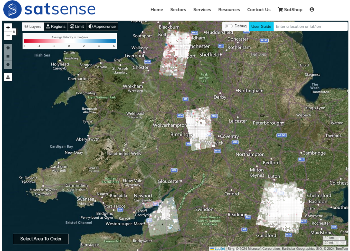
Image: Example high resolution InSAR data stacks over London, Bristol, Birmingham and Manchester.
Why Choose High Resolution?
High-resolution data unlocks new possibilities by offering:
- Higher Point Density: Improved identification of fine spatial patterns.
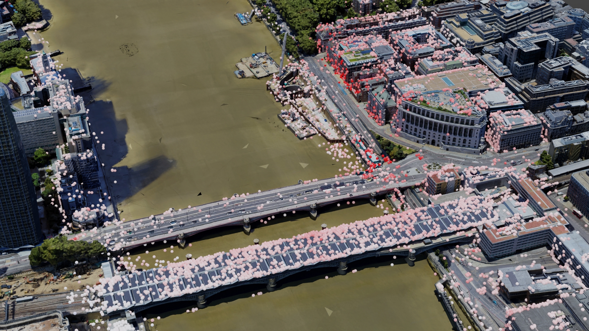
- Enhanced Geo-Positioning Precision: Sub-meter geolocation precision of points enables applications like tracking the displacements of individual buildings or road segments.
- Greater Sensitivity: Detect even smaller displacements with improved accuracy.
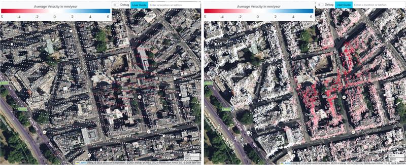
Image: Right) C-band Sentinel-1 Left) X-band TerraSAR-X over a subsidence bowl in Mayfair, London resulting from recent construction works. The subsiding area is visible in both datasets, but the spatial patterns of which buildings are affected are easier to identify with X-band.
Comparing Standard and High Resolution InSAR
Standard Resolution | High Resolution |
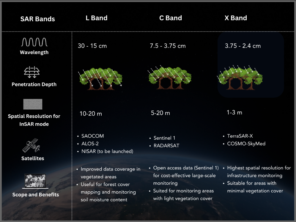
C-band (6 cm λ) | X-band (3 cm λ) |
5 x 20 m resolution cell | 3 x 3 m resolution cell |
6 – 12 day repeat | 11-day repeat |
Regular gridded product | Improved geo-positioning in XYZ |
Image: Comparison of different SAR wavelengths.
Discover the Difference High-Resolution InSAR Data Can Make
Ready to explore how our high-resolution X-band InSAR data can enhance your projects? Contact us today to learn more about our regional subscription services or request a demo!
Image: InSAR displacement on Blackfriars bridge, London.


