Regional Subscription Services - Permian Basin (USA)
Permian Basin InSAR Monitoring Service
The Permian Basin, one of the world’s most prolific oil and gas regions, is a cornerstone of energy production for the USA. However, production in the Permian Basin comes with challenges, most notably with produced water.
Up to eight barrels of produced water are brought to the surface with every barrel of oil. Produced water is then disposed of in the subsurface by reinjection. This has the potential to induce seismicity and escape to the surface through existing conduits, such as abandoned wells.
The ongoing injection and withdrawal of fluids into subsurface reservoirs changes pore pressure and subsurface stresses, to produce observable surface deformation. This surface deformation can be monitored with InSAR, highlighting areas that are experiencing elevated stress.
SatSense leverages decades of expertise in wide-area deformation monitoring, earthquake analysis, and tectonic movement detection to provide the actionable insights operators require to effectively manage wastewater injection and hazard mitigation.
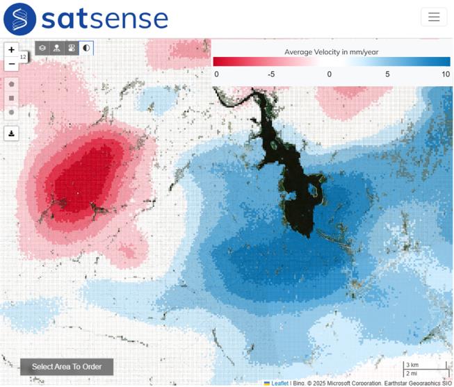
Image: InSAR velocity map of the Northen Delaware basin where red areas are subsiding and blue zone represents uplift associated with saltwater disposal injection.
Key Features of our Permian Basin Subscription Service:
- Remote deformation monitoring at all scales: From basin-wide monitoring across the Delaware, Midland and Central Basins, to well-scale insights.
- Timely Updates: Automatic updates with each satellite overpass every 12 days, with a latency of less than 24 hours.
- Historical Insight: Have the capability to turn back time as every ground measurement data point has a time history, in most cases back to 2015.
- Access via API or the SatSense Analysis Platform: Incorporate the data into existing software via or API, or access insights anytime and anywhere through our user-friendly portal - ensuring teams are always aligned.
- Complementary Technology: Improve your understanding of your subsurface assets by integrating surface movement data with geological, geophysical and other GIS datasets
Image: Photo of an oil production site in the Permian Basin, overlaid with five service icons
Take Action
- Detect and Respond to Hazards: Identify dynamic spatial and temporal patterns of displacement to proactively manage operations and infrastructure integrity
- Optimise Water Disposal Activities: Gain critical insights into the impact of saltwater disposal (SWD) and wastewater injection operations.
- Enhance Compliance: Meet regulatory requirements with transparent, data-driven reporting. Monitor back in time to support investigations and reporting.
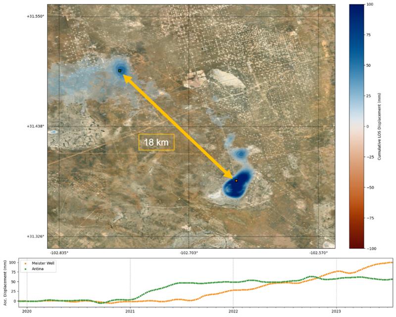
Image: InSAR displacement showing two different uplifting zones connected at depth.
Supporting Sustainable Growth
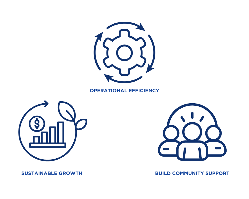
As oil and gas production scales, so does the need for sustainable practices. SatSense enables operators to:
- Minimize Environmental Impact: Identify and mitigate risks that could lead to spills, infrastructure failures, or other environmental incidents.
- Improve Operational Efficiency: Leverage data to optimize drilling, completions, and water management strategies.
- Build Community Trust: Demonstrate proactive risk management and transparency to stakeholders and local communities.
Why Choose SatSense?
In the fast-paced Permian Basin, you need a partner who can keep up with the demands of your operations. SatSense delivers:
- Expertise: Decades of experience in satellite monitoring, tectonics and geohazards
- Innovation: Cutting-edge InSAR and analytics powered by our proprietary algorithms.
- Reliability: Trusted by leading operators globally to deliver actionable, accurate insights.
- Support: Access to our team of InSAR and Geosciences experts.
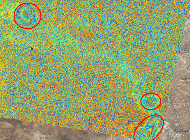
Image: 12-day differential interferogram, with three distinct uplifting shallow deformation features identified automatically with SatSense early warning alerting system.
Get Started Today
Ready to transform how you operate in the Permian Basin? Contact SatSense to learn more about our subscription services and see how our advanced geospatial solutions can work for you.


