Property and Insurance
Take the Risk Out of Insuring Properties
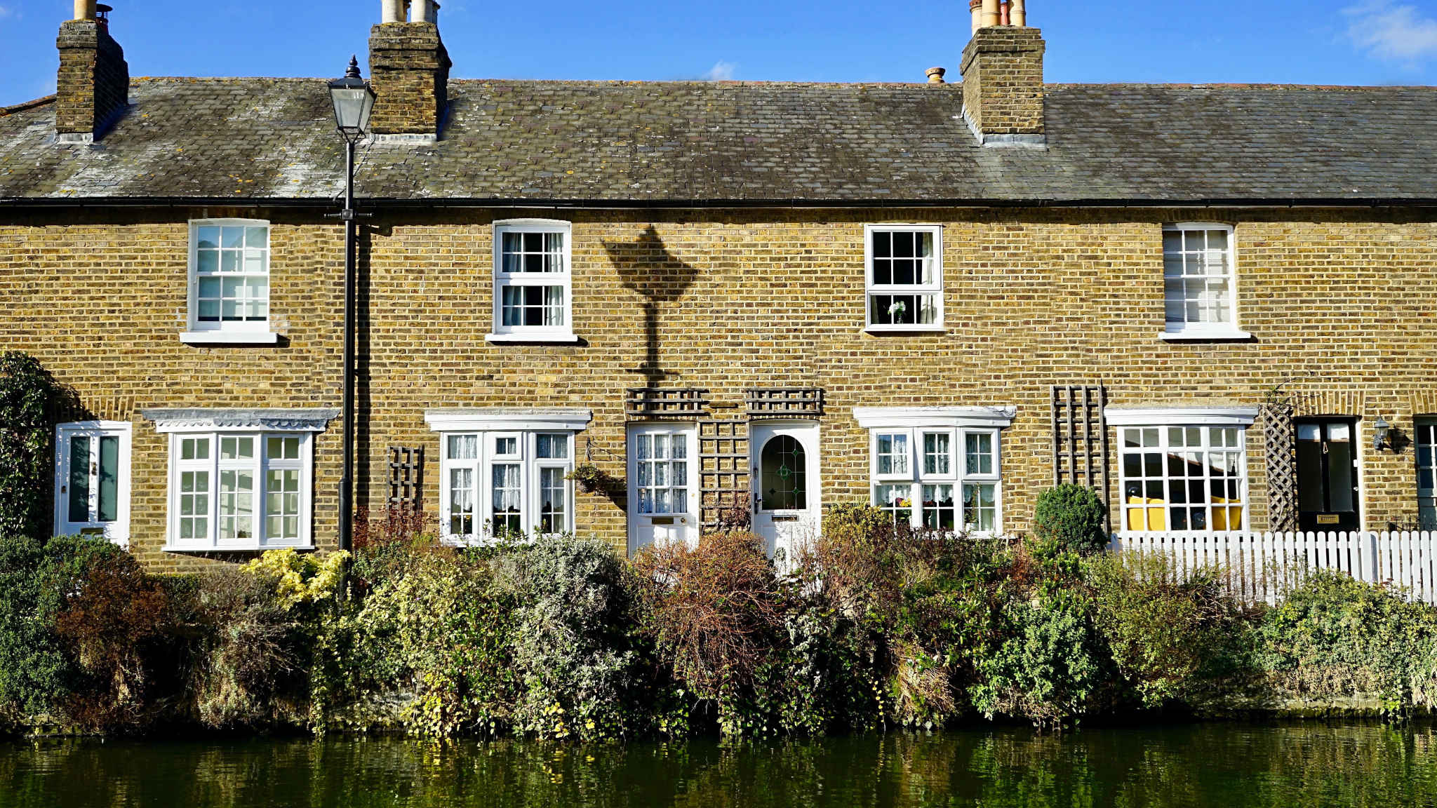
Property Damage from Ground Movement
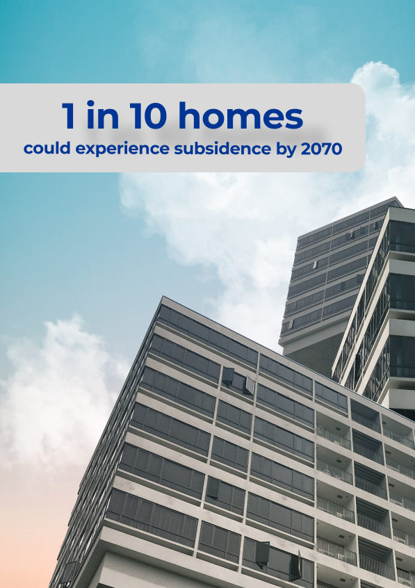
The number of insurance claims arising from damage to property from ground movement in the UK has been rising in recent years, and the annual cost can exceed £100 million. The Financial Conduct Authority (FCA) defines four main causes of damage related to ground movement.
- Subsidence occurs when the ground beneath a building sinks, pulling a property’s foundations down with it.
- Settlement, on the other hand, is downward movement due to compression of the ground by the weight of a building, within 10 years of construction.
- Landslip is the downward movement of sloping ground.
- Heave is upward movement of the ground beneath a building due to expansion of soil beneath.
The detection and monitoring of all these processes can benefit from InSAR monitoring by SatSense.
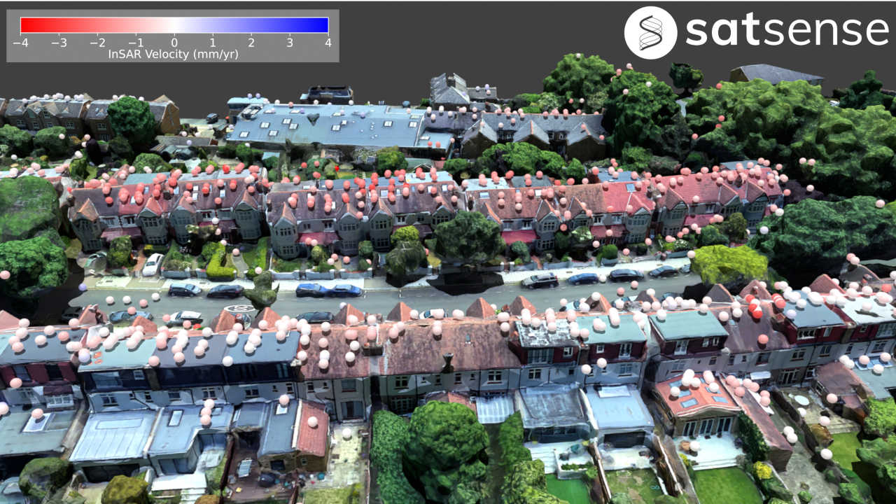
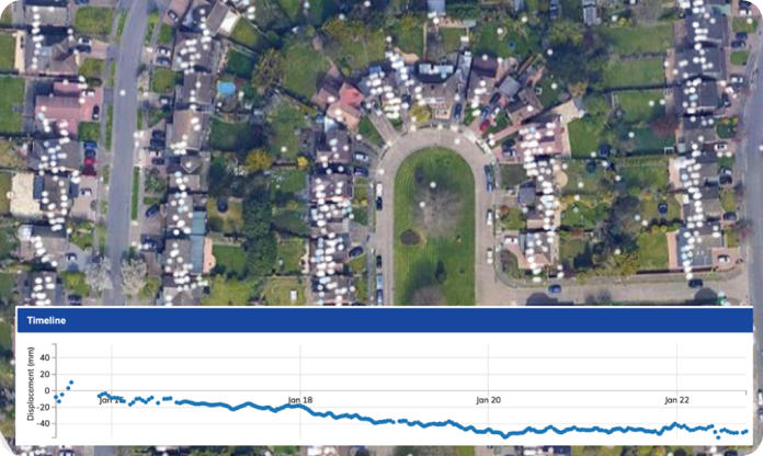
Detecting Ground Movement at Property Level
Movement of properties typically starts long before any significant damage is caused. Meaning, the earlier that ground movement is identified, the more power property owners have to predict and place preventative measures for potential damage.
InSAR satellite monitoring technology detects ground displacement at the property level in near-real-time. Movement datasets are accessible via our SatShop portal, where data is updated every six days, or query our bespoke property risk indices to quickly assess several movement risks across individual properties or an entire investment portfolio.
Automatically Identify Risk Across Properties
Building movement typically starts long before any significant damage is caused. This means that the analysis of building movement from InSAR data has predictive power for potential damage.
SatSense produces a series of risk indices, based on different aspects of ground movement, that are of interest to insurance companies and purchasers of property. Processes that can flag an increased risk of ground movement at a property include:
- Local ground instability
- Trees that affect the nearby water table
- Building works
Settling Insurance Claims Rapidly
When an insurance claim for property damage is made, 6 to 18 months of building monitoring on the ground is typically needed to demonstrate seasonal movement, which is both expensive and time-consuming. Tracking subsidence using the archive of SatSense InSAR data can offer an alternative approach that delivers results without delay and at a lower cost.