The UK population rely on these dams as a source of clean water and considering how long ago these assets were built, it is vital that they are consistently monitored.
Keeping on top of dam safety
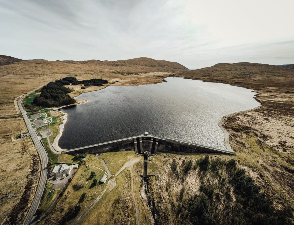
The safety of dams and their surrounding assets is of key importance to understand but can be a challenging task to undertake, especially across concrete core dams when internal erosion is difficult to determine. Currently one of the main ways in which dam safety is being managed is by undertaking visual inspection and measurements. Engineers inspect the dam and surrounding areas for signs of crack, bulges and hollows on both the downstream and upstream face, when the water is low. Any of these signs can be a signal of a dam becoming unstable with potential to collapse or cause flooding. Concrete dams will also have tunnels running through them so that an engineer can inspect the dam's condition from the inside also, as this is often the first area problems appear.
Due to the nature of dams, they can move, expand and shrink with effects from nature. Water can seep through small gaps and pores and, a dam can even shrink under the sheer weight of its structure. Civil engineers design dams specifically to avoid these changes as much as possible, but this still must be overseen periodically after construction. A dam's job is to hold back gallons of water in a reservoir and therefore, very specific calculations need to be made in order to ensure that the walls are built with the correct diameter and height, but is the same care and precision put into the aftercare?
How can InSAR help?
This infrastructure can be protected using Interferometric Synthetic Aperture Radar (InSAR) technology due to its ability to collect a high density of data points on any ground movement over large areas. Historically, existing monitoring programmes are concentrated around the dam, meaning ground movement around surrounding areas such as rock slopes above the dam could be missed. The implications of not understanding how the surrounding area is behaving may go undetected until the displacement is at a high magnitude and affecting the dam.
Data points can be automatically collected and processed without any engineer needing to be present, and are not subject to human errors with accuracies obtained within +/- 1 mm/yr.
With the frequency of UK government reporting requirements ranging from 1 to 10 years, there is potential for large amounts of time to pass with problems going undetected. InSAR can be used to measure subsidence, and ground or structure movement over time and with SatSense technology we provide a six-day update timeframe, putting safety in the palm of your hands, all accessible in our SatShop portal.
Interested in finding out more about how SatSense’s InSAR data could aid protect your assets? Then get in touch to speak to our specialist or read our full user guide here.