Available Anywhere?
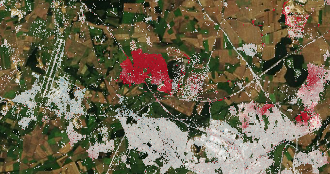
SAR data is available almost everywhere around the globe, which means InSAR is ideally suited to monitoring ground movements at scale. However, global data availability should not be confused with InSAR ground measurements being available everywhere. The below image clearly shows some areas being densely covered by measurements, but also large areas where we get sparse or no coverage.
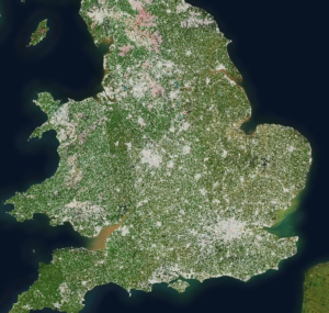
InSAR measurements are the result of a difference between two images. We rely on the ground surface to provide a consistent reflection at both times; the reflective properties of the area have to stay nearly the same between the images. Some types of reflective surfaces, like man-made objects (buildings, infrastructure), bare ground and exposed rocks are very consistent and thus generally result in good coverage. Dense woods (leaf on-off, branches moving in wind) and agricultural fields (fast growing, ploughing) are very inconsistent and thus generally have less or no measurement coverage. This effect can be clearly seen in the overview image of most of England and Wales, showing dense coverage over urban areas, major highways and railways, with much sparser coverage over thinly populated areas.
Improving Results
A large part of processing time goes into identifying which points are consistent measurements, and which points are meaningless. Unfortunately, we are limited in what we can do to increase measurement coverage in certain areas in our historic data. This is a physical limitation of the InSAR technique; there is no ground movement information contained in those points.
Broadly speaking, there are two things we can do to improve measurement coverage in marginal areas. The first is to use higher resolution data. By looking at smaller areas, you improve the chance of each area being consistent. The second is to install artificial reflectors, providing guaranteed measurement points with known locations for future measurements.
SatSense can process freely available standard resolution satellite data or commercially available higher resolution satellite data. SatSense can also provide and install artificial reflectors to enhance coverage in areas of low naturally-occurring consistent reflectors. Selecting the best option depends on the application and specific area. Based on an analysis of free historic data, SatSense can work with you to evaluate which option would be most suitable, and deliver this as part of an InSAR monitoring solution.
To discuss your ground movement analysis or monitoring project, contact us today.